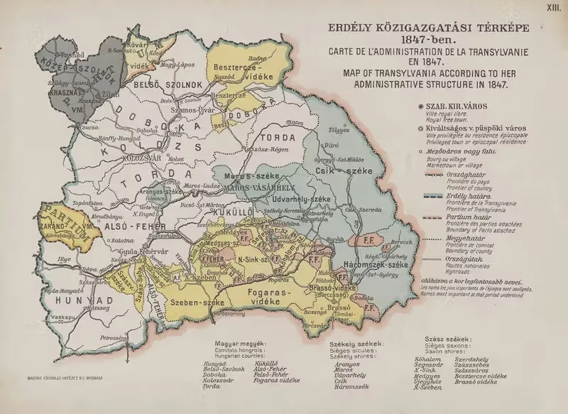
Map of Transylvania according to her administrative structure in 1847 (1920)
Hungarian Geographical Institute1920 · Landscape
Add to a brief →
Rights checked · print-ready master at your size · adapted to your space on request
Specifications
- Year
- 1920
About the artwork
"Map of Transylvania according to her administrative structure in 1847" (1920) is a work by Hungarian Geographical Institute. The catalogue places it in Illustration. The format is landscape.
"Map of Transylvania according to her administrative structure in 1847" is available for commercial licensing as a print-ready master. A landscape format suits wide, low wall spaces such as the stretch above a bed, mantel, or sideboard. Add it to a brief and we send a shortlist for your space, with the source, rights status and a project licence you can show your client.
About the artist
Hungarian Geographical Institute is featured in our catalog. 9 works by the artist are available on onlly.art.
If you like the visual language of Hungarian Geographical Institute, explore more works by the same artist in our collection.
MORE WORKS BY THIS ARTIST